Lake Maggiore Routes
davidof
Posts: 3,127
A few years back I asked about routes around Lake Maggiore and got some help from Andy Miller amongst others but there didn't seem to be much information. I've now spent 3 summers in the area with my bike and wanted to share some of the routes I've ridden in the hope this may be useful. I'll rely on Strava for the routes but can share gpx files elsewhere if there is demand..
Ornovasso / Boden / Alpe Rossombolmo
50km/1500m climbing from Baverno

This fearsome climb starts from the village of Ornavasso just north of Gravellone-Toce. Ornovasso (Umfasch) is an old Swiss Valser colony and some of the older locals still speak a kind of German dialect which is very hard to understand even for German speakers. You'll be climbing in pro cyclist Elisa Longo Borghini's training ground, she lives near the base of the climb. The route to the summit is rated harder than Mortirolo and Mt. Zoncolan.

After the 15km ride on main roads (thankfully quiet at 7am) I reached Ornavasso and took the left turn signposted for Boden. You pass by a number of churches.

finally reaching the right turn for Cortevechio just before the Boden Sanctuary. The road continues through a series of villages. In general it is well surfaced with around 9-10% grade but with little climbs around 15%. All pretty nice until at 970 meters altitude or 8km the road becomes pot holed and there is a 2km section around 19% with sections of 33%.

I'd suggest a 34x32 combo for the climb if you are on compact or something bigger on an MTB. The road flattens at Schrimbei hamlet

with views over Lake Maggiore and Mergozzo
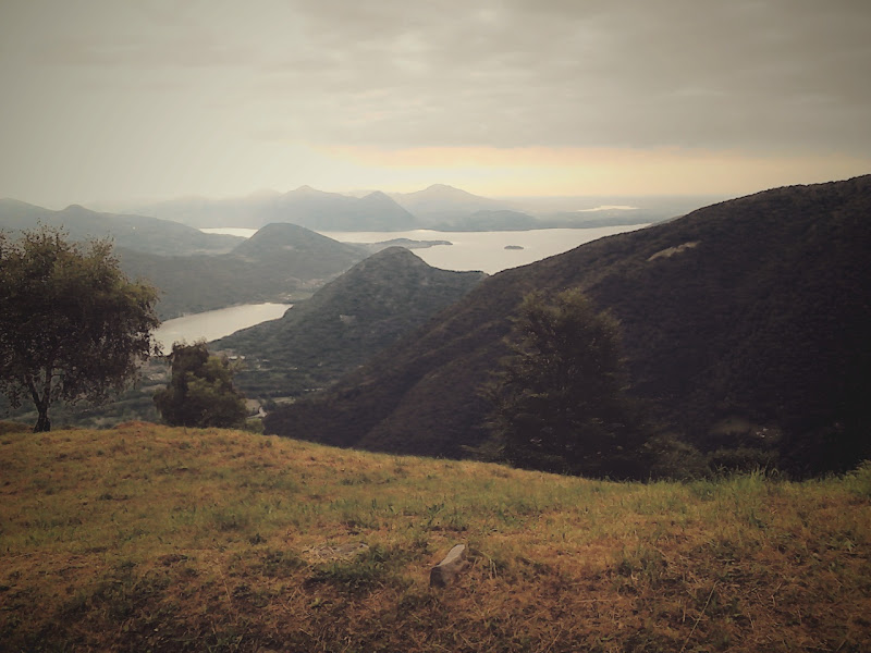
I stopped at Cortemezzo just before the final "wall" due to time but will be back next year. Remember you have to ride down what you came up. I tackled bit of the 2km steep section MTB style with my backside hung way back on the bike for balance. I was using 25mm tires on Open4 CD 36x wheels. Pretty robust stuff. Returning to the Boden road I climbed the 300 meters to Boden where there is another church. Again the place names reflect the Swiss Valser dialect.

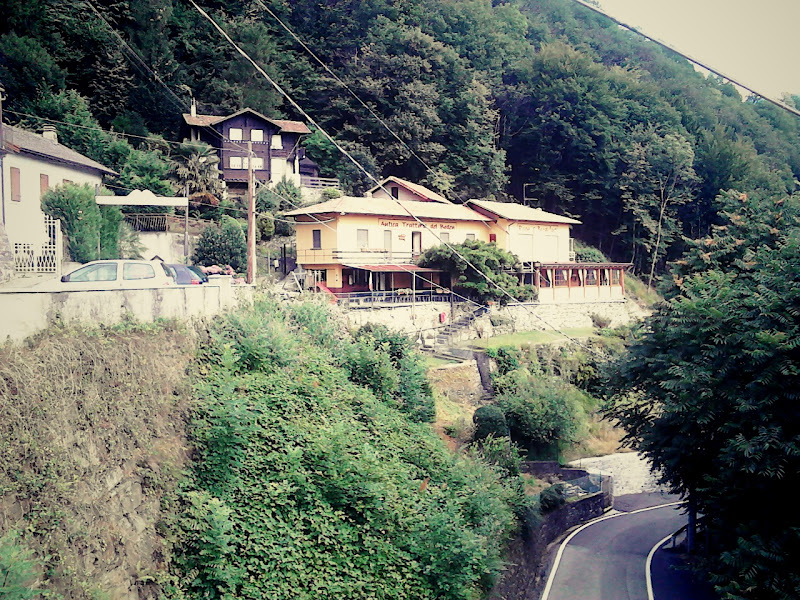
at Boden there is a Trattoria which also offers rooms: http://www.trattoriaboden.it/
The ride down to Ornavasso is fast. At the village cross over the main road to head to a suspension bridge (cycles and pedestrians only). This takes you across the river and onto the Mergozzo road. Mergozzo is an interesting city with a 12th century church and a good cafe stop by the lake.
Avoid on weekends due to the number of cars on the narrow roads.
https://www.strava.com/activities/343247269
Verbania - Piancavallo
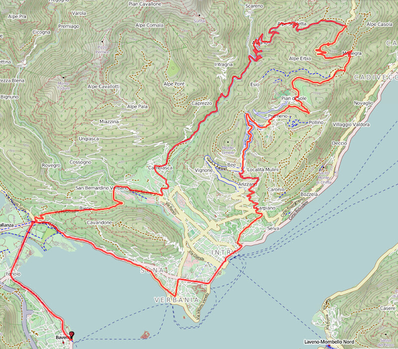
60km/1400m climbing from Baveno

From Verbania there are two ways to tackle this loop. The steep hairpins of Bée overlooking the lake which then lead to a long climb to the ski resort of Premeno / Prian Di Sole. (http://www.piandisolesci.it/) before a gentle descent through woods then a final 4km climb to the Piancavallo view point. Here you turn left to Aurano. A very steep descent in places on a singletrack road through hamlets clinging to the hillside. After Aurona the grade flattens to around 5% for a fast descent through a steep valley with gorges to Verbania.
Tackled in the reverse direction and you have the very steep climb from Aurona with hairpins that will challenge any cyclist with a fast descent from Piancavallo to Verbania.
https://www.strava.com/activities/341478597
Gravellona Toce / Alpe Quaggione
40km/1200 meters.

From the fishing village of Feriolo

ride towards Gravellona-Toce. After 2 round-a-bouts take a left onto Via Granerolo a a hamlet. This is a tricky left turn due to poor visibility on the main road. Via Granerolo climbs over to Sant'Anna on a road with a series of short but steep climbs. At Sant'Anna traverse across to Via 6 Novembre via an industrial estate then double back 300 meters to sharp right hander marked Gatugnu/Montebuglio. This is a pleasant 7% climb to Gatugnu but at the exit of the village the road narrows and is not as well surfaced and gets much steeper, over 11% to Alpe Colla where there is a crossroads and restaurant.
From here follow the steep climb to Alpe Quaggione and even higher if you have the legs for it.
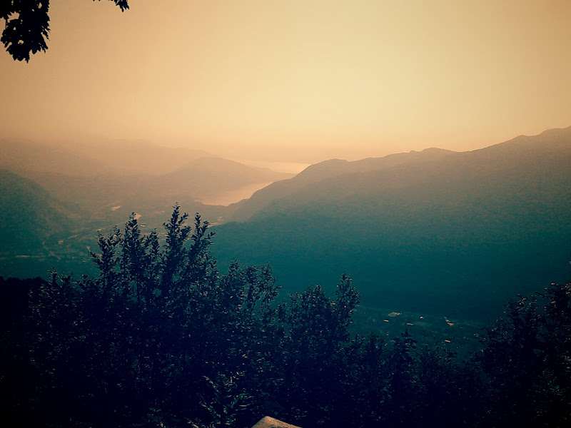
Return via the same route or Montebuglio and Gravellona Toce.
https://www.strava.com/activities/339665227
Mottarone SW Side Loop
50km, 1500 meters.

I climbed this in 2014 in the coldest July in years and it was sleeting at the summit. Mottarone is the big hill behind Stresa and rise to around 1450 meters with a ski resort on the top. From Baverno I followed the same initial route as Alpe Quaggione above, this is Feriolo than the little climb down to Sant'Anna known as the Mortirolo segment on Strava. From Omegna at the top of the Orta lake I followed the climb to Agrano (7% over 2.3km) then Armeno. From here the climb to the Mottarone starts proper on a well surfaced but steepish road. You are looking at 10km at 8% giving you 800 meters of vertical to the cross roads with the toll road. The 2km out of Armeno are closer to 12%. For extra brownie points you can loop round the summit of the Mottarone then follow the toll road down directly to Gignese. This is free to bikes but 7 euros for cars. It is steep and poorly surfaced at the start but they've redone the road lower down. There is a nasty one km climb up to the top of Gignese and the bottom toll booth which you pass on the far right. Then down via Gignese and Stresa or Baverno.
https://www.strava.com/activities/165390839
Mottarone from Stresa / Alpino
40km/1300m
This is the classic climb in the area to the ski resort of Mottarone from Stresa. From the coast road follow road signs for Mottarone near the Borremeo Palace Hotel. The climb is some 20km over 1300 meters at 6% but this disguises some sharp changes in gradient. Climb to Vezzo (6km) then Gignese where you take a right at traffic lights onto the via Alpino (note there have been some one way changes in 2015 which may change the exact route). Above Gignese there are some ramps of more than 15% and the final part of the toll road is both on a pot holed surface and over 10%. There are cafes on the Mottarone and excellent views of the surrounding lakes.
https://www.strava.com/activities/65832694
Alpi Ompio, Verbania

From Fondotoce take the road to Bieno and at the col take a left at the lights into the village. The village has a steep wall before descending slightly to the San Bernardino road. Here left to climb to the alpine pasture of Alpa Omio through pine forests. The road has a series of ramps with a 2km section at 12%. From Fondotoce you climb 730 meters vertical over 9.2km giving 8% average. The road is a dead end but you can descend to San Bernardino and into the Verbania backcountry.
https://www.strava.com/activities/165392917
Ornovasso / Boden / Alpe Rossombolmo
50km/1500m climbing from Baverno

This fearsome climb starts from the village of Ornavasso just north of Gravellone-Toce. Ornovasso (Umfasch) is an old Swiss Valser colony and some of the older locals still speak a kind of German dialect which is very hard to understand even for German speakers. You'll be climbing in pro cyclist Elisa Longo Borghini's training ground, she lives near the base of the climb. The route to the summit is rated harder than Mortirolo and Mt. Zoncolan.
After the 15km ride on main roads (thankfully quiet at 7am) I reached Ornavasso and took the left turn signposted for Boden. You pass by a number of churches.
finally reaching the right turn for Cortevechio just before the Boden Sanctuary. The road continues through a series of villages. In general it is well surfaced with around 9-10% grade but with little climbs around 15%. All pretty nice until at 970 meters altitude or 8km the road becomes pot holed and there is a 2km section around 19% with sections of 33%.
I'd suggest a 34x32 combo for the climb if you are on compact or something bigger on an MTB. The road flattens at Schrimbei hamlet
with views over Lake Maggiore and Mergozzo
I stopped at Cortemezzo just before the final "wall" due to time but will be back next year. Remember you have to ride down what you came up. I tackled bit of the 2km steep section MTB style with my backside hung way back on the bike for balance. I was using 25mm tires on Open4 CD 36x wheels. Pretty robust stuff. Returning to the Boden road I climbed the 300 meters to Boden where there is another church. Again the place names reflect the Swiss Valser dialect.
at Boden there is a Trattoria which also offers rooms: http://www.trattoriaboden.it/
The ride down to Ornavasso is fast. At the village cross over the main road to head to a suspension bridge (cycles and pedestrians only). This takes you across the river and onto the Mergozzo road. Mergozzo is an interesting city with a 12th century church and a good cafe stop by the lake.
Avoid on weekends due to the number of cars on the narrow roads.
https://www.strava.com/activities/343247269
Verbania - Piancavallo

60km/1400m climbing from Baveno
From Verbania there are two ways to tackle this loop. The steep hairpins of Bée overlooking the lake which then lead to a long climb to the ski resort of Premeno / Prian Di Sole. (http://www.piandisolesci.it/) before a gentle descent through woods then a final 4km climb to the Piancavallo view point. Here you turn left to Aurano. A very steep descent in places on a singletrack road through hamlets clinging to the hillside. After Aurona the grade flattens to around 5% for a fast descent through a steep valley with gorges to Verbania.
Tackled in the reverse direction and you have the very steep climb from Aurona with hairpins that will challenge any cyclist with a fast descent from Piancavallo to Verbania.
https://www.strava.com/activities/341478597
Gravellona Toce / Alpe Quaggione
40km/1200 meters.

From the fishing village of Feriolo
ride towards Gravellona-Toce. After 2 round-a-bouts take a left onto Via Granerolo a a hamlet. This is a tricky left turn due to poor visibility on the main road. Via Granerolo climbs over to Sant'Anna on a road with a series of short but steep climbs. At Sant'Anna traverse across to Via 6 Novembre via an industrial estate then double back 300 meters to sharp right hander marked Gatugnu/Montebuglio. This is a pleasant 7% climb to Gatugnu but at the exit of the village the road narrows and is not as well surfaced and gets much steeper, over 11% to Alpe Colla where there is a crossroads and restaurant.
From here follow the steep climb to Alpe Quaggione and even higher if you have the legs for it.
Return via the same route or Montebuglio and Gravellona Toce.
https://www.strava.com/activities/339665227
Mottarone SW Side Loop
50km, 1500 meters.

I climbed this in 2014 in the coldest July in years and it was sleeting at the summit. Mottarone is the big hill behind Stresa and rise to around 1450 meters with a ski resort on the top. From Baverno I followed the same initial route as Alpe Quaggione above, this is Feriolo than the little climb down to Sant'Anna known as the Mortirolo segment on Strava. From Omegna at the top of the Orta lake I followed the climb to Agrano (7% over 2.3km) then Armeno. From here the climb to the Mottarone starts proper on a well surfaced but steepish road. You are looking at 10km at 8% giving you 800 meters of vertical to the cross roads with the toll road. The 2km out of Armeno are closer to 12%. For extra brownie points you can loop round the summit of the Mottarone then follow the toll road down directly to Gignese. This is free to bikes but 7 euros for cars. It is steep and poorly surfaced at the start but they've redone the road lower down. There is a nasty one km climb up to the top of Gignese and the bottom toll booth which you pass on the far right. Then down via Gignese and Stresa or Baverno.
https://www.strava.com/activities/165390839
Mottarone from Stresa / Alpino
40km/1300m
This is the classic climb in the area to the ski resort of Mottarone from Stresa. From the coast road follow road signs for Mottarone near the Borremeo Palace Hotel. The climb is some 20km over 1300 meters at 6% but this disguises some sharp changes in gradient. Climb to Vezzo (6km) then Gignese where you take a right at traffic lights onto the via Alpino (note there have been some one way changes in 2015 which may change the exact route). Above Gignese there are some ramps of more than 15% and the final part of the toll road is both on a pot holed surface and over 10%. There are cafes on the Mottarone and excellent views of the surrounding lakes.
https://www.strava.com/activities/65832694
Alpi Ompio, Verbania

From Fondotoce take the road to Bieno and at the col take a left at the lights into the village. The village has a steep wall before descending slightly to the San Bernardino road. Here left to climb to the alpine pasture of Alpa Omio through pine forests. The road has a series of ramps with a 2km section at 12%. From Fondotoce you climb 730 meters vertical over 9.2km giving 8% average. The road is a dead end but you can descend to San Bernardino and into the Verbania backcountry.
https://www.strava.com/activities/165392917
BASI Nordic Ski Instructor
Instagramme
Instagramme
0
Comments
-
-
Around the foothills of Lake Maggiore (Stresa / Baveno)
Beligrate - Cologna
30km/630m (from Baveno, return via Levo)
Short training route. From Stresa ride down the lake to Beligrate where you take a right turn to the village (one way - Via Novembre). Pass under the railway line to the Via Panorama to Cologna. A 400 meter climb at 7% with views of the lake. At Cologna continue North to Stropino through the Stresa golf course then either return to Stresa or climb to Vezzo and take the descent via Levo to Stresa/Baverno.
Mur de Massena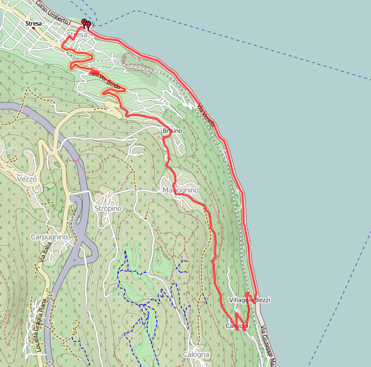
4 km south of Stresa take a left at Bezzi village to climb the 22% slopes of Via Massena then Magognio - Brisino to return to Stresa and Baverno via the Stresa railway station (via di Piemonte)
https://www.strava.com/activities/340966168/
Alpino Village
25km/750m climbing from Stresa/Baverno
More a training run above Stresa. From the North end of town by the traffic lights at the stop of a small hill take the 2nd left to Someraro. Don't be put off by the steep drag through the village, it soon settles down to zig-zags with an average 8% grade. At Someraro take the left to Levo then through the village to join the main Stresa-Orta road. Climb towards Gignese, at the end of a 1 way system take a right onto Via Arcioni and climb to Alpino via a series of zig-zags. There is a small alpine garden at Alpino with views over the lake. Continue to the cross-roads just after the Camini camping where you take a left to descend on a fast, but tricky road to the typical village of Gignese (umbrella museum) then via the main road to Stresa.
https://www.strava.com/activities/340321246
Santa Salvatore, Lesa
I discovered this climb quite by accident after taking a wrong turn out of Lesa. Basically follow the coast road from Stresa to Lesa. On the straight in Lesa you come to traffic lights signposted to the right to Comnago and Massino. The climb to Massino is 200 D+ at 8%. Continuing out of Massino to the SW you come across a right turn to the hilltop hamlet of Santa Salvatore. 5.5km climb at 9% from Lesa but be warned, the last km is at 13%. Descend back to Massino and take the road through town (maybe one way for 100 meters) to Brovello then onto the Orta/Stresa road.
https://www.strava.com/activities/165441900
L'Ordin / Levo
7.6km/540 meters
From Baveno take the Via Monta Grappa through the center of town past the history Gevasio church. Climb to Someraro then Levo (6km at 7%) on a nice, well surfaced road with views of the lake, never too steep. In Levo by a school take a right onto Via Mottarone. At the hamlet of Ordin you can descend a steep road to the small housing estate of la Cristina. The climb back up is 13% over 600 meters.
https://www.strava.com/activities/165391999/segments/3847740212
Lesa / Comnago
35km/800 meters
From Baveno (or Stresa) ride to Lesa along the coast road (12.5km). At the traffic lights in town turn right to Comnago. Pass under a railway line and after a left hand bend take a sharp right to Comnago. The road begins to climb and zig-zag through vinyards with views of the lake. At Comnago you can continue on a very steep, but short climb to Calogna then Stropino or left on a flattish road through woods to Carpugnino. From here climb to Vezzo then right to Levo to descend to either Stresa or Baveno.
https://www.strava.com/activities/65833488/segments/1258781194
Church of St Jean, Monterfano Fondotoce
110 meters V+ / 16%
This short, sharp climb is on the southern end of lake Mergozzo just off the Verbania - Gravellona highway by Verbania-Pallanza railway station. Passing in front of a quarry complex it leads to the old village of Monterfano and its 11th century church of St Jean. There has been a church on the site since the 5th century. There is a small restaurant at the top of the village with a viewpoint over lake Maggoriore.
https://youtu.be/3Y-JOSMpHm4BASI Nordic Ski Instructor
Instagramme0 -
Bike Shops
Marco's Bike
http://www.marcosbike.com/ - piazza Cavour 42, Verbania
Ver-Bike
Corso Europa, 64, Pallanza VB, Italy
Phone:+39 0323 501475
http://www.verbike.it/
CIPRIAN ENRICO
7, Via Castelli Giuseppe - 28922 Verbania (VB)
tel. 0323 502401
A. S. BICICO
Piazzale Lido, 8
28838 Stresa VB
Road and Mountainbike hire from the Cable Car station in Stresa
http://www.bicico.it/
Limited supply of road bikes
Cicli Prezan
Viale V. Veneto, 9
28822 Cannobio VB
Tel 0323 71230
http://www.cicliprezan.it/chi_en.phpBASI Nordic Ski Instructor
Instagramme0

