bit of a Garmin moan/rant plus Garmin Edge 500 route questio

ben-----
Posts: 573
I've just got and started to use a new Garmin Edge 500 (from the recent Amazon flash sale). I got it to replace my 200 (which I used solely for navigation to follow new routes), and for use on a turbo trainer (with its HRM and cadence/speed sensor ability).
In the mean time, before I started using the 500, in a fit of "what the hell", I also got myself a second hand 800, thinking I'll sell the 500. I used the 800 for a while and didn't think that much of it. Didn't like the design, the way it worked, the whole user interface of it, also physically, it's size. In theory the maps is a massive plus but the way Garmin have done it I didn't like. I also found every time it beeped to say turning coming up, Garmin had very cleverly made the map completely vanish for a brief period just after that beep -- the point when you look at it. Brilliant. Also me having made a turn, just before, the map would freeze, so after I've made the turn the map being showed is out of orientation, 90deg one way or the other say, because it's frozen and I've turned, which then added further major confusion to where I was supposed to go especially if there was another turning right away. I mean bloody hell. There was a whole bunch of other things I didn't like about it. I will admit though, it did basically, I'm saying this begrudgingly, work. In a manor.
I found the 200, *strictly* only for navigation, following a route, nothing else (not even logging the ride - I used a little GPS logger box for that), really good. Really worked well for me. (God help me if I expected and tried to use it to accomplish further things.)
Because the 800 was much more expensive and I didn't even like it that much and it was so much bigger, and because I thought the navigation on the 500 would be the same as it is on the 200, I thought, actually, I'll not sell the 500 but sell the 800 instead.
That's what I've done. Without trying the 500 first.
Just been out to test the navigation on the 500 (hilariously, on a route which went past a post office to send my just sold 800). It's broken. The course keeps disappearing. I think it gave up beeping when I was supposed to turn (I prepared the course and edited the turnings carefully and appropriately on ridewithgps.com). It gave up possibly navigating, I don't know what happened or what it did. But it was a mess. There's no way I'm going to be able to follow an unknown route with that. That's not a criticism of the "breadcrumb" style of routing (I found navigating on the 200 great) but 500's implementation or failure to implement it. As I say, it's broken.
What is it with Garmin? They really need to not bother getting up in the morning any more.
The question:
Anyway, is there anything I can do to get the navigation to work OK (route not keep vanishing) on the 500? It's software version is 3.30 which is the most recent it appears.
If not I think I'll have to go back to a 200 - for navigation. Which is a bit ridiculous. 200>800>500>200. Not sure what I'd do for the turbo. I've got and was planning on selling a CatEye V3 which has cadence+speed sensor and HRM. Maybe I'd keep that but it only recording average and maximum heart rates was what made me consider changing to 500 or 800 in the first place. Or keep the 500 just for turbo. I don't know.
I wish a decent company would come along and do cycle computers. Then Garmin would either go away or bother to do some decent work. Either way I'd be happy.
0
Comments
-
Whilst I'm not sure I understand your approach or recognise the issues you are having with the 800, I do absolutely understand your frustration with Garmin. So many friends have said to me that they wish there was a good alternative to Garmin - is it really THAT hard? I'm finding my old 800 more reliable than the 1000ROAD < Scott Foil HMX Di2, Volagi Liscio Di2, Jamis Renegade Elite Di2, Cube Reaction Race > ROUGH0
-
Look at your course settings on the 800 by default navigation is OFF. The map screen should appear at turns if you have auto scroll set to off.
 0
0 -
freezing77 wrote:Look at your course settings on the 800 by default navigation is OFF. The map screen should appear at turns if you have auto scroll set to off.
Too late - he's sold it ROAD < Scott Foil HMX Di2, Volagi Liscio Di2, Jamis Renegade Elite Di2, Cube Reaction Race > ROUGH0
 -
Garmin have avoided spending any money on software (products and website) or testing.
They really wouldn't exist if anyone else decent came along.
The market must be big enough now for someone else to enter. If I was strava or something like that, I'd be investing. 0
0 -
Garmin were an absolute software nightmare. They used to have the complete mindset of hardware engineers that had no concept of what their users wanted to actually do. It was a GPS version of British Leyland.
This was evident by the fact that there you used to have to go through all sorts software tools and conversion apps developed by enthusiasts because they were so bad with their desktop software. I suspect what has kept the firm alive was that they kept getting the hardware right or certainly better than smart phones.
I had thought that they'd upped their game software-wise, but if the OP is right maybe they've just moved to the 'almost usable' level.
Honestly I'd love to give a senior person over at Garmin a damned good talking to before smart phone batteries improve and wipe them out.0 -
I'm amused by your use of the past tense. I'm not sure how you can run a GPS company without good software/firmware guys. But they are dire. Provided my 800 doesn't get too wet, it works most of the time. The 1000 though is another kettle of fish. And then there's Garmin Express, Garmin Connect etc which rarely work as intended.ROAD < Scott Foil HMX Di2, Volagi Liscio Di2, Jamis Renegade Elite Di2, Cube Reaction Race > ROUGH0
-
About the vanishing route problem I asked about, I've found a bunch of pages of stuff from people with the same problem on Garmin's forum, eg:
https://forums.garmin.com/showthread.ph ... urse/page4
And it's from years ago. And there's no decent solution from what I can see. The only possible solution is to downgrade the software (but presumably that'll make other things worse, plus I really don't fancy the rigmarole of jumping through all their hoops to get to be able to install the software and possible side effects, and that's assuming the older versions are available). From that page I linked to, talking about the problem of vanishing course:Which firmware are you running?
- Anything up to 2.5 incl. - no prob.
- From 2.6 up to 2.8 incl. use GPSies workaround. Upload your current track and download with option "set trackpoints evenly"
- Running 3.0? Downgrade!!!!
That was written in 2012. The latest software version is 3.30 which is dated August 7, 2013. And they haven't bothered fixing it. They're selling something which is clearly broken.0 -
I'm in the same boat - had an Edge 200, used it very successfully for navigation, wanted ant+ features and picked up an Edge 500 on an unmissable deal. Discovered that navigation on the Edge 500 is useless due to the disappearing trail line.
My solution is to just mount both - that way you have one screen for ride data, one screen for navigation. It did come in handy having the both on an Audax once when the 500 lost part of my ride, I was able to just copy the missing data from the track on my 200.
Unfortunately it does mean you look a bit of a Fred, and your clubmates will look at you funny and ask why on earth you have two Garmins.
To be quite honest, if someone could tell me that the Bryton Rider 40 works exactly as the 500 ought then I'd probably just buy one of those and have done with it, but first hand opinions seem hard to find.0 -
meanredspider wrote:The 1000 though is another kettle of fish.
Yeah I saw your post in the stuff you've just bought thread a few days ago talking about that. Shocking. Unacceptable. I admire your apparent lack of rage") I'd be livid.TimothyW wrote:My solution is to just mount both - that way you have one screen for ride data, one screen for navigation.
I'd be livid.TimothyW wrote:My solution is to just mount both - that way you have one screen for ride data, one screen for navigation.
Blimey. Have you by any chance tried it with older software? According to the quote from the page I linked to 2.5 is fine - for routing, but who knows what would then not be OK. Seeing as routing is one of the main things I got the 500 for maybe I should give that a go. Don't fancy it. It ain't gonna be fun. Especially on a Mac. I bet Garmin will have made it even more unpleasant/tricky for that.0 -
I have the breadcrumb trail working on my 500 with latest firmware. It does involve gpsies.com. And if memory serves I use the set trackpoints evenly and the medium algorithn - which may or may not make any difference.
Completed a 50 miler on Sunday with no dropouts.Felt F70 05 (Turbo)
Marin Palisades Trail 91 and 06
Scott CR1 SL 12
Cannondale Synapse Adventure 15 & 16 Di2
Scott Foil 180 -
meanredspider wrote:I'm amused by your use of the past tense. I'm not sure how you can run a GPS company without good software/firmware guys. But they are dire. Provided my 800 doesn't get too wet, it works most of the time. The 1000 though is another kettle of fish. And then there's Garmin Express, Garmin Connect etc which rarely work as intended.
well they make good gps tracking hardware and the software that goes around that, the thing knows where you far more accurately than my mobile phone with GPS + added mobile phone signal + wifi location capabilities. my phones tracking GPS jitter (essentially where it leaps about trying to work out where I am) can add anything up to a 20% extra distance even over quite small distances, which is quite an error margin to cater for,whilst my 500 seems rock steady on location.
where Garmin dont excel is turning that kind of location side technology theyve got,into something more usable in the fitness/cycling/running type mode, because its just an offshoot of probably what they saw as their traditional main market shares which is in aviation/marine/car navigation, where you just want fairly basic navigation between places but absolute accuracy in location, and dont need great bits of software to make it work or plan routes.
all the stuff we as cyclists want like monitor and record all this data and following breadcrumb trails and show maps and record the temperature etc etc and fit it on this tiny device with next to no memory or processor because you want ultimate longness in battery life.
yep Im not surprised a) they muck that up, and b) no-one else is placed to disrupt the market by introducing something that actually works, Strava arent big enough to get into the hardware side as well,and get more users from being device agnostic, everyone else sits and sees Garmin reporting 70% growth in a not terribly large market sector.
fwiw my 500 is at 3.40 firmware now,and has been fairly regularly updating over the last year, not saying it fixes any of these problems, as Ive had problems with it myself and lost fair amount of data at times, but the updates are still coming...for now.0 -
Are they really that bad?
I can't stop at a set of lights in the morning without hearing about 5 different "you've stopped" bleeps from various other riders.0 -
Daniel B wrote:I have the breadcrumb trail working on my 500 with latest firmware. It does involve gpsies.com. And if memory serves I use the set trackpoints evenly and the medium algorithn - which may or may not make any difference.
Completed a 50 miler on Sunday with no dropouts.
I'll give gpsies a go. Thanks.awavey wrote:fwiw my 500 is at 3.40 firmware now, ...
I don't think it matters that much, but 3.3, August 7, 2013, is the most recent I've seen
http://www8.garmin.com/support/download ... sp?id=47150 -
The reason there are no more updates for the 500/800 is because they have been 'superceded' by the 510 / 810 respectively.
I've had an 800 since they came out and whilst I agree that Garmin's software and testing are awful (they seem to use their customers as beta testers) and they don't seem to be that helpful in terms of support, I've never had an issue with my 800 and I've never experienced the routing issues mentioned either. I've happily navigated routes up to 200 miles with no issues. I use bikeroutetoaster to generate courses though - I never let it figure out where to go itself though, so am not really using it to it's full (supposed) capability0 -
My Edge 810 works perfectly most of the time. Does get the occasional glitch but all in all I'm very happy with it. The software is appalling though. I plan via RideWithGPS and use Strava for most other things.
- 2023 Vielo V+1
- 2022 Canyon Aeroad CFR
- 2020 Canyon Ultimate CF SLX
- Strava
- On the Strand
- Crown Stables
0 -
ben----- wrote:Daniel B wrote:I have the breadcrumb trail working on my 500 with latest firmware. It does involve gpsies.com. And if memory serves I use the set trackpoints evenly and the medium algorithn - which may or may not make any difference.
Completed a 50 miler on Sunday with no dropouts.
I'll give gpsies a go. Thanks.awavey wrote:fwiw my 500 is at 3.40 firmware now, ...
I don't think it matters that much, but 3.3, August 7, 2013, is the most recent I've seen
http://www8.garmin.com/support/download ... sp?id=4715
Just to add, as the above reply was via my mobile, I had exactly the same issue when I bought my 500 2-3 years ago, and found the same forum posts that you did - I downgraded to 2.80 I think it was, and that seemed to fix it - at the time I was mapping with bikehike.
But I found a post somewhere that said to use gpsies, and to use the medium algorithm combined with setting the course points evenly - I choose those options, and save it as a TCX file, then drop it in the 'new files' folder, and swich it on for it to then convert the file to a .fit one it understands. Recently garmin express automatically upgraded mine to the latest firmware, but it's still been working fine, so that's the method I use.
Gave up with the turn indicators a while back, never got them to work for me properly or reliably, and personally find if I have the map zoomed to 300ft, that is ample (usually, unless the map delays updating for a bit) to spot turns etc etc
If I want data and a map simultaneously, for example if I want to carry out a training ride on a brand new route, then I will use the 500 for data, and will bring my Edge 205 into play for the mapping.
However if someone knows a reliable method of getting turn alerts/indicators onto the 500, I may well give that a go.Felt F70 05 (Turbo)
Marin Palisades Trail 91 and 06
Scott CR1 SL 12
Cannondale Synapse Adventure 15 & 16 Di2
Scott Foil 180 -
I have a 500 and only use ridewithgps.com on it. Plan your route, export as a GPX file to the "new files" folder on your garmin, turn it on and there's your route. That will give audible bleep indicators when you're coming up to a turn, give road names and turn by turn directions, all whiles following the breadcrumbs. Only gets really tricky when there's two or more roundabouts in quick succession as it can take a while to update. I've ridden in completely unfamiliar surroundings with this system and it hasn't failed me. Note: I always have a downloaded map of the area on my phone in case of road closures etc. no way of changing the route once you're out!
Hope that helps,
Rob0 -
You can always turn the beeps off. I have on mine.Rick Chasey wrote:Are they really that bad?
I can't stop at a set of lights in the morning without hearing about 5 different "you've stopped" bleeps from various other riders.
I have an 800. There are certain things which could be improved software wise but it does work as advertised and I haven't seen any disappearing route issues. When there is a turning right after another one the nice big white arrow goes round them both (providing navigation is turned on).0 -
Daniel B wrote:Gave up with the turn indicators a while back, never got them to work for me properly or reliably, and personally find if I have the map zoomed to 300ft, that is ample (usually, unless the map delays updating for a bit) to spot turns etc etc
Right, thanks. Yup, I made a route with ridewithgps, got the turn cues just right (I always delete the ones which don't correspond to a turning, and add turnings where ridewithgps misses them), downloaded as tcx (which definitely has turn cue data in), uploaded to gpsies, turned on points at even spacing and the medium simplification algorithm, downloaded as tcx.
That certainly helped the vanishing route problem. It did go a wrong at times. Eg showed a long straight road ahead when the road had a clear right angle bend just ahead. Generally went a bit skew-if. But corrected itself reasonably quickly without me doing anything. Also quite a lot of "off course" beep warnings, when I wasn't, only to say "course found" few seconds later. Route still vanished for little whiles but only seconds - rather than, I think, minutes previously.
So definitely a big improvement because it was hopeless before. But all the turn cues were absent. Which is not good.Moldy wrote:I have a 500 and only use ridewithgps.com on it. Plan your route, export as a GPX file to the "new files" folder on your garmin, turn it on and there's your route. That will give audible bleep indicators when you're coming up to a turn, give road names and turn by turn directions, all whiles following the breadcrumbs.
Well there's a thing. I had always thought tcx was the format to use to get turn cues. I didn't realise gpx has turn cues in. So that's the next thing for me to try. Thanks for that suggestion. Which software version is your 500 using?0 -
ben----- wrote:Moldy wrote:I have a 500 and only use ridewithgps.com on it. Plan your route, export as a GPX file to the "new files" folder on your garmin, turn it on and there's your route. That will give audible bleep indicators when you're coming up to a turn, give road names and turn by turn directions, all whiles following the breadcrumbs.
Well there's a thing. I had always thought tcx was the format to use to get turn cues. I didn't realise gpx has turn cues in. So that's the next thing for me to try. Thanks for that suggestion. Which software version is your 500 using?
My 500 isn't even recognising a gpx file from ridewithgps as a route (and opening it up in a text editor, it appears not to have any turn data).
Did you mean tcx, not gpx?0 -
Sorry, yes meant tcx! Sorry for making you waste your time! Not sure what firmware I'm on either, will have a look on the commute tomorrow.
Rob0 -
Moldy wrote:Sorry, yes meant tcx! Sorry for making you waste your time! Not sure what firmware I'm on either, will have a look on the commute tomorrow.
Rob
Thought so Still be interesting to know what your software version is. If it's 3.4 might be worth me having a go at upgrading that. Thanks. 0 -
I think if I recall correctly I had a similar issue when I tried to plot the ride on bikehike, set course points and then ran it through gpsies.
The turn indicators were either all removed or only some of them would show up, and I had what you had on your first gpsies ride, ie the route would still dissapear for a few seconds at a time, where as originally it would dissapear for long periods of time.
After that I went just through gpsies, where I have a feeling there is no option to set turn indicators, and the map never dissapears for me on my 500 with the latest firmware.Moldy wrote:I have a 500 and only use ridewithgps.com on it. Plan your route, export as a GPX file to the "new files" folder on your garmin, turn it on and there's your route. That will give audible bleep indicators when you're coming up to a turn, give road names and turn by turn directions, all whiles following the breadcrumbs. Only gets really tricky when there's two or more roundabouts in quick succession as it can take a while to update. I've ridden in completely unfamiliar surroundings with this system and it hasn't failed me. Note: I always have a downloaded map of the area on my phone in case of road closures etc. no way of changing the route once you're out!
Hope that helps,
Rob
Hi Rob, so when you plot the route with wwgps the breadcrumb trail works fine for the whole route, or do you tend to run on data and rely on the turn indicators, so are not on the map that much?
I would like to get the turn indicators working, but it's whether I can be @rsed to go through it all again really.Felt F70 05 (Turbo)
Marin Palisades Trail 91 and 06
Scott CR1 SL 12
Cannondale Synapse Adventure 15 & 16 Di2
Scott Foil 180 -
Daniel B wrote:After that I went just through gpsies, where I have a feeling there is no option to set turn indicators, and the map never dissapears for me on my 500 with the latest firmware.
I just made a test route on RwG, with turn cues, exported it as tcx, uploaded it to gpsies, exported it as tcx with set points evenly. Opened up both tcx files in text editor, copied the section on the end of the first RwG tcx between inclusively the tags <CoursePoint> and </CoursePoint> which contain all the turn cues - separate from the Track (which is the actual route) data points. Pasted that into the appropriate position near the end in the second gpsies tcx (the CoursePoint section was entirely absent in that - hence why gpsies tcx doesn't give any turn cues), saved, copied to Edge 500. I have't ridden the route, so not properly tested, but just from sitting here and looking at it on the device I can see the route is in there apparently fine and has the turn cues.
edit: slight correction: there are a list, a bunch of, "CoursePoint"s, loose as it were, not in their own single containing tag, following on after the closing </Track> tag. That's, however many there are, what needs copying and pasting.
So I'll test that properly at some point by riding a route done like that. Seems that route length might have some bearing. Long ones more likely to cause problems.Daniel B wrote:Moldy wrote:I have a 500 and only use ridewithgps.com on it. Plan your route, export as a GPX file to the "new files" folder on your garmin, turn it on and there's your route. That will give audible bleep indicators when you're coming up to a turn, give road names and turn by turn directions, all whiles following the breadcrumbs. Only gets really tricky when there's two or more roundabouts in quick succession as it can take a while to update. I've ridden in completely unfamiliar surroundings with this system and it hasn't failed me. Note: I always have a downloaded map of the area on my phone in case of road closures etc. no way of changing the route once you're out!
Hope that helps,
Rob
Hi Rob, so when you plot the route with wwgps the breadcrumb trail works fine for the whole route, or do you tend to run on data and rely on the turn indicators, so are not on the map that much?
Also, typically how long are the routes?0 -
ben----- wrote:Moldy wrote:I have a 500 and only use ridewithgps.com on it. Plan your route, export as a GPX file to the "new files" folder on your garmin, turn it on and there's your route. That will give audible bleep indicators when you're coming up to a turn, give road names and turn by turn directions, all whiles following the breadcrumbs. Only gets really tricky when there's two or more roundabouts in quick succession as it can take a while to update. I've ridden in completely unfamiliar surroundings with this system and it hasn't failed me. Note: I always have a downloaded map of the area on my phone in case of road closures etc. no way of changing the route once you're out!
Hope that helps,
Rob
Hi Rob, so when you plot the route with wwgps the breadcrumb trail works fine for the whole route, or do you tend to run on data and rely on the turn indicators, so are not on the map that much?
Also, typically how long are the routes?[/quote]
I think you may have hit the nail on the head there, I seem to recall my brother finding a stat that the number of coursepoints that an Edge could hold (Admittedly on a 205) was something like 100, and that was across ALL courses held on the device, but that there was no way to determine which 100 would stay, it would randomly dissapear them from certain courses.
I tend to have around 12 courses on my Garmin at a time, probably totalling something like 500ish miles, so you can imagine the number of coursepoints that would be required in that case.
IF that is the case, the only way I can see you could do it would be to only have one route on there at a time, but I wonder if I might find that a bit of a pain - ie having to plan in advane what course you want to ride.
Intrigued by the way you are opening the files up with a text editor, this hadn't even occurred to me, would be interested to hear if that works in anyway for you at all.Felt F70 05 (Turbo)
Marin Palisades Trail 91 and 06
Scott CR1 SL 12
Cannondale Synapse Adventure 15 & 16 Di2
Scott Foil 180 -
Tested it on a 50 mile route today, with about 50 turn cues. On one hand it worked, on the other it didn't.
The worked bit:
On the route line, the cue signs, the little squares with right/left/straight arrows appeared fine and correctly.
The didn't work bit:
No beep as passing through those arrow points. And the count down distances, the numbers at the top of the route map, broken, showing nothing throughout whole ride.
And the route line behaved generally OK.
It is starting to behave a bit more like the 200 though. I'll hold off from getting another 200.
I have an idea why it didn't work properly and therefore have an idea how to get it working - which I may have a go at some time.Daniel B wrote:IF that is the case, the only way I can see you could do it would be to only have one route on there at a time
I don't think the number of routes is the issue, I think it may be the length (or maybe some other characteristic) of the course being followed. But I could be wrong. The first time I used it and it went really haywire I only had one route on I think.0 -
Hi both, sorry for the late reply, long week!
Never thought of using the text editor, when I ride with new routes (upwards of 100miles on occasion) the breadcrumb trail works fine the entire time, as do the turn beeps and the distance countdown to the next turn. If it's a totally unfamiliar route I will leave the map screen running the whole time. I do have the fairly slow refresh issues, particularly after taking roundabouts in quick succession but other than that no problems at all! I've also got approximately 25 routes saved in the courses folder at any one time. I tend to delete them, and activity data periodically but that's more to save time scrolling through trying to find the right one on the device itself!
How do I find what version I'm on?
Hope that helps, sorry to hear you're having so much trouble. The fact that breadcrumbs work so well for me and that ridewithgps gives me road names and turn indicators means that I don't think I'll ever need to upgrade to one with maps.
Rob0 -
When you make a route on ridewithgps do you edit them much / at all, or just accept the first route ridewithgps gives? Just curious.
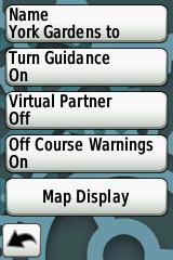
You get the software version by choosing Settings from the main menu, then About Edge from the next menu.0 -
Sometimes I make my own routes if there are particular places I want to go. If it's a totally new part of the country, I tend to search for other peoples routes, in the hope that they will know some good roads. Then I just edit the start/end points and go with it.
Rob0 -
I've managed to get the turn cues to work with the gpsies route. (Wrote some 'puter code which takes the gpsies and ridewithgps versions of the route for its input, it takes the turn cues from the ridewithgps version, then reassigns those points to the appropriate points in the gpsies version. Tested yesterday, turn cues worked 100% ) Still getting the route disappearing but only for a few seconds rather than minutes.
Rob, I'm still very much interested in which software version your 500 is using though, as it working fine directly from ridewithgps routes would be good. Thanks.0