London to Paris - Garmin 1000

lancew
Posts: 680
I'm looking at guiding a group to Paris in July and I have been offered a Garmin Edge 1000 as a ride computer by the company running it. I will also be allowed to use this for training, and after as long as it is available when they want to use it.
What is the general consensus on the maps on the Garmin. I need something that I can put a route into and then follow with guidance that will be reliable, and have the battery life to last 8-10 hours in the saddle for the trip.
I am pretty sure its the kit for the job I just wanted to check that I am not ripping work off, as I believe I can put the maps onto the 510 if I have a route, but I think that the security of having a working GPS navigation in case we get into any troubles.
On top of this has anyone tried using the mapping systems in France at all? How does it compare?
Specialized Allez Sport 2013
0
Comments
-
Why not an 800 or 810? They both have maps and cost a lot less than a 1000. The 510 is limited to only showing a line and direction arrows - no proper mapping, but turn-by-turn works if you route the course/route properly.
Routing can be a pain if you want turn-by-turn navigation as well. But if you just map out the route, it is very simple to do using Garmin Connect or anything else (even downloading ready-made courses/routes). (If you use the computer to select the route for you then that does turn-by-turn navigation, but means you can't be sure which roads you'll take.)
Also, I don't think paying for the map packs is worth it - the openstreetmaps options are much better.Brim Cycling Channel - My YouTube Channel
My Strava Profile -|- My Instagram
ActiveBeans - A Veggie Lifestyle Blog0 -
Cheers I will look into that.
I have had a look on my LBS's website (Panagua Bikes Hayes, they're amazing) and will have a word to see if I can trial run each of them.Specialized Allez Sport 20130 -
The Garmin 1000 uses Open Street Maps now, and in the EU ships with maps that cover the EU preinstalled.
Haven't used it in France yet, but it's worked very well in the UK when we've visited other places and followed the route from that.
When we went to California I loaded a set of maps (again, free OSM) and it worked perfectly out there as well.
Just make sure you have a recent firmware update - the first couple of versions had navigation issues.
This guide nails it: http://www.forgot.co.uk/garmin-edge-nav ... edge-1000/0 -
If somebody else is paying but the 1000 with maps0
-
Battery life may be a problem, read up on power saving prior to the trip. i.e turn of glonass, do not have the map page on as the main page, turn off auto scroll etc etc.
Maybe one of the anker or similar power units may be advisable in case you run out of power.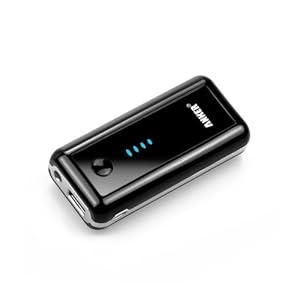
http://www.amazon.com/5600mAh-Portable-External-Smartphones-including/dp/B005K7192G0 -
Thanks for the help guys.Specialized Allez Sport 20130
-
Definitely as above with the power saving- I went on a 160 mile ride with my club in the summer, where we had a mix of phones, edge 800s, 510s, and 810 and my 500. Even with the portable chargers recharging the other units at the halfway point my edge 500 was the only unit standing once we got back.
Unless you can stop at least once for a good recharge I wouldn't have thought the battery would last the trip.
As for the maps, it depends what comes loaded on the unit/ map pack you have. If it's just the very basic base map then it may not be so useful- but if it has a European map pack installed it should work reasonably well, although some of the smaller roads might not show up.
Good luck!0 -
After 100 miles, my 1000 is normally 50% battery or just over. The longest I have used it, on all the time, was for a 9 hour period. It had 40% remaining. I also have Glasnoss off and have it set to a data screen, with auto scroll to the map screen for when it wants me to negotiate a road junction. Keep route re-calc off if you want to follow a set route. I used mine in France for a weekend cycling around Le Touquet. The 1000 comes with hi rez full EU mapping on board. It knew that roundabouts had to be negotiated anti clockwise! Impressive.
The 1000 screen is far superior to my old 800 (an 810 is the same as an 800), the unit has far superior waterproofing and it will also display your Di2 battery level, if you use that. The fact that your route can be live tracked by others (an 810 will also do this) is another nice touch, especially as friends and family may want to follow your progress to Paris.
You also won't need your laptop to upload your ride data each evening, as it synchs to your phone and auto uploads when you save a ride. If using it in France, just make sure you have an EU data package (O2's is about the best) from your network provider.
I'm doing Paris in August and will be using my 1000. We are doing 340 miles in 3 days.Boardman Elite SLR 9.2S
Boardman FS Pro0