route mapping
mmuk
Posts: 398
Hi
i'm sure this will have been covered somewhere, but I can't find it!
I'm thinking of buying a 'route device' (garmin/whatever) for touring (UK and EU) audaxes and general not getting lost purposes.
I prefer OS type maps, and see this as an alternative to carrying bundles with me (especially when travelling around the EU).
Presuming some of you have experience of these things, advice on what to get would be very welcome.
ta
MM
0
Comments
-
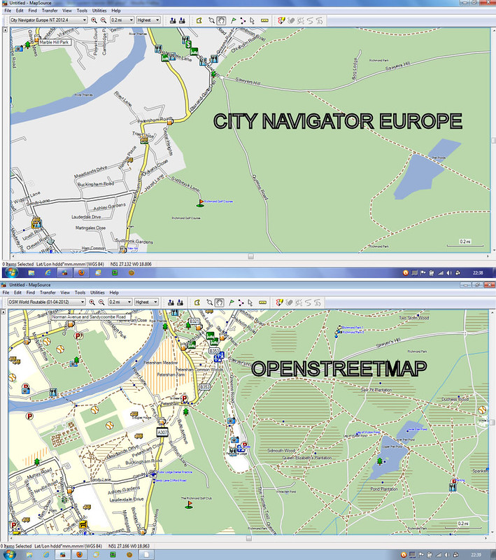
Openstreetmap and city navigator europe comparison
 0
0 -
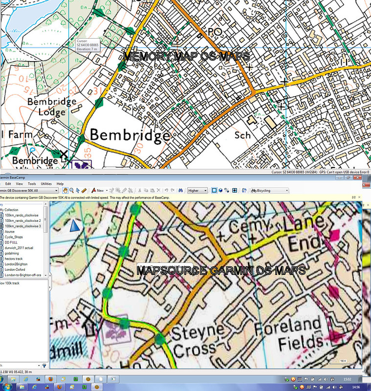
Comparison of os maps from memory map and from garmin. Note garmin only have certain areas of the uk at 1:25 k the rest are 1:50k. Memory map have them for the whole of the uk at 1:25k.
 0
0 -
FWIW my opinion for general use something like the etrex 20 loaded with openstreetmap (free).
Why the etrex as opposed to the obvious edge series, use bog standard aa batteries. Longer battery life than the inbuilt battery on the edge series and it has an electronic compass something the edge series are lacking.
If you want a touch screen consider the dakota 20.0 -
are the openstreetmap in etrex 20 scrollable and expandable when loaded or fixed?0
-
mmuk wrote:are the openstreetmap in etrex 20 scrollable and expandable when loaded or fixed?
You can pan and zoom the map using the joystick button for pan and side buttons for zoom in and out.0 -
The zoom range is something like 20ft to 1000s of miles, I don't have any of my gps's with me but its something like house level zoom to continent level0
-
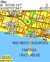
Etrex screen shot OSM
 0
0 -
I seem to be something of a lone voice in this respect, but I personally don't rate the OpenStreetMap stuff. The quality of the mapping seems to vary considerably from area to area, and having tried a number of downloads for my local area (Surrey / West Sussex) I'm yet to find a good one. There seem to be an awful lot of things marked on the OpenStreetMap maps that aren't public rights of way. I also have issues with the way they zoom, with minor roads not being visible on the Garmin unless zoomed in to a level that renders the map itself pointless.
That said, the OSM stuff's free, so giving it a go on a suck-it-and-see basis is no real loss.Mangeur0 -
AchillesLeftKnee wrote:I seem to be something of a lone voice in this respect, but I personally don't rate the OpenStreetMap stuff. The quality of the mapping seems to vary considerably from area to area, and having tried a number of downloads for my local area (Surrey / West Sussex) I'm yet to find a good one. There seem to be an awful lot of things marked on the OpenStreetMap maps that aren't public rights of way. I also have issues with the way they zoom, with minor roads not being visible on the Garmin unless zoomed in to a level that renders the map itself pointless.
That said, the OSM stuff's free, so giving it a go on a suck-it-and-see basis is no real loss.
You can change when things such as minor roads become visible, this setting will inflluence how long the screen takes to redraw.
Secondly if you note errors join the osm community and correct the errors for the benefit of all.0 -
Any chance you could point me at some instructions for that? The ability to prioritise what's shown would help massively.freezing77 wrote:
You can change when things such as minor roads become visible, this setting will inflluence how long the screen takes to redraw.AchillesLeftKnee wrote:I seem to be something of a lone voice in this respect, but I personally don't rate the OpenStreetMap stuff. The quality of the mapping seems to vary considerably from area to area, and having tried a number of downloads for my local area (Surrey / West Sussex) I'm yet to find a good one. There seem to be an awful lot of things marked on the OpenStreetMap maps that aren't public rights of way. I also have issues with the way they zoom, with minor roads not being visible on the Garmin unless zoomed in to a level that renders the map itself pointless.
That said, the OSM stuff's free, so giving it a go on a suck-it-and-see basis is no real loss.Mangeur0 -
Will send later when I am home0
-
AchillesLeftKnee wrote:Any chance you could point me at some instructions for that? The ability to prioritise what's shown would help massively.
It depends on what model gps you have, but on my eTrex 20, when you are in map view you click on the menu button on the left of the device and then click 'Setup map', then 'Advanced Map Setup ('Text Size, Zoom etc)'. Then click 'detail' (Most/More/Normal/Less/Least). You can also control whether you see additional information by clicking on Zoom Level. I've never touched the 'Text size' option but you might also want to adjust that.freezing77 wrote:Etrex screen shot OSM
I'm puzzled - that looks like a screenshot from an older model eTrex. The map rendering on the newer models (eg eTrex 20 is much better).0 -
This is from an old model (legend hcx)I am not at home and the only pictures I have access to are on flickr, well spotted0
-
Another option on the etrex series that you may find beneficial is the ability to create a route on the device by picking multiple points on the map. This way when the device calculates the route it will go through your chosen via points to the end point.
On the edge 800 you can only choose the end point and have little control of the calculated route.0 -
freezing77 wrote:Another option on the etrex series that you may find beneficial is the ability to create a route on the device by picking multiple points on the map. This way when the device calculates the route it will go through your chosen via points to the end point.
My variation on that (I never worked out how to do it the more complicated way) is simply to choose a point a few kilometres down the line and then get the device to navigate to that (keeping an eye on what it tells me) and then repeat as necessary.
One thing that bugged the heck out of me until I turned it off, was the auto-zoom (you reach a junction and suddenly the device zooms in, which you might want, or you might not). You can turn it off in the setup map settings.0

