Pyrenees map
rc856
Posts: 1,144
Hi folks,
I was wondering if anyone can recommend a map that will cover all the major climbs of the Pyrenees between Bayonne and Toulouse?
I know I can buy the IGN ones but think I'd need 4 separate maps to cover the area.
Ideally I'd get one that I can still see the cols on?
Many thanks
PS: While I'm on the Pyrenees.....is the Rapha book worth buying or is there any others that are just as good? A mate is just getting into cycling and I'm trying to inspire him to join me on a trip there.
0
Comments
-
IGN do some maps that are 1:100,000 (although those may be the ones you are referring to when you talk about needing to buy 4). Michelin are reasonably good for marking the altitude of cols. You might be able to get one at 1:200,000 that covers the Pyrenees.0
-
Thanks mate.
I need to be improving my Google searching!!
Think the IGN ones are split into 100 or so
that cover the country. Thought it was either
one big one or the 4 but I'll check out Michelin ones.0 -
The one you need is from the Michelin 1/200000 series (1cm = 2km): number 85 : 'Biarritz Lourdes Bagneres-de-Luchon' It covers all the climbs in the Western Pyrenees. To cover Toulouse you would also need number 82 - say you were cycling from the airport to the mountains.
You could also purchase number 86 : 'Bagneres-de-Luchon Andoore Perpignan which covers the eastern Pyrenees'.T Farr0 -
Michelin 1:150,000 scale, Number 342 (Hautes Pyrenees & Pyrenees Atlantique) will cover 99% of what it sounds like you're after on one map. CheersBetween me & Eddy Merckx we've won pretty much everything worth winning on a bike.0
-
You can see some map samples at the foot of this page - it's about my ride over the mountains...
http://www.crazyguyonabike.com/doc/page ... 36423&v=rzIt's an uphill climb to the bottom0 -
Excellent.
Thanks again0 -
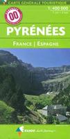
IGN have a map in their "Spéciales" "Culture & Environnement" series that covers the entire Pyrenees coast to coast in both France and Spain at 1:400,000. I did the Raid with this (and admittedly a Garmin) and it was more than sufficient- bear in mind that in these mountains there generally only is the one road going up to the col so a high level of detail is not really required. It says 3615 IGN on the back but I think this is for the series rather than the number of the individual map. Barcode on mine is 3282118301324.

on Amazon.fr0

