New trails in Ogliastra, eastern Sardinia
Peter Herold
Posts: 59
Round where we live in Ogliastra, eastern Sardinia, we are organising a couple of things to improve local riding and enable more people to ride here:-
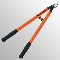
1. pruning the good, natural (shepherds') singletrack which descends from Baunei round the SW side of Monte Scoine to Santa Maria. This is through rocky limestone country, nice rocky steps, and over 5 days 2-3 of us each armed with are pruning the vegetation by the path
2. with Italian mountain bikers from Nuoro and cagliari we are riding the souther loop of the "T-track". This is a 250-km figure-of-8, in places waymarked

though the new sections of track which we supposed to be built never were. So we are going to ride (roughly) the route of the T-track, using alternative shepherd's paths/tracks, see photo http://www.mtb-forum.it/community/forum/picture.php?albumid=5530&pictureid=38611
new walking paths

or fire trails. Though the fire trails were once passable by car, in many places they have been damaged in flash flooding, and so give rough, rocky riding in places see http://www.mtb-forum.it/community/forum/picture.php?albumid=5530&pictureid=38608&thumb=1
or, simply, since vehicles can't go on them, in places they are covered in grass or wild flowers, which at this time of year are lovely. We do our first section this Sunday, 4-5 of us, and by the end of May should have documented 100km of trails, with gpx files put on the web, seehttp://www.mtb-forum.it/community/forum/picture.php?albumid=5530&pictureid=38872
For info, contact me at peter@peteranne.it
Peter
1. pruning the good, natural (shepherds') singletrack which descends from Baunei round the SW side of Monte Scoine to Santa Maria. This is through rocky limestone country, nice rocky steps, and over 5 days 2-3 of us each armed with
 are pruning the vegetation by the path
2. with Italian mountain bikers from Nuoro and cagliari we are riding the souther loop of the "T-track". This is a 250-km figure-of-8, in places waymarked

though the new sections of track which we supposed to be built never were. So we are going to ride (roughly) the route of the T-track, using alternative shepherd's paths/tracks, see photo http://www.mtb-forum.it/community/forum/picture.php?albumid=5530&pictureid=38611
new walking paths

or fire trails. Though the fire trails were once passable by car, in many places they have been damaged in flash flooding, and so give rough, rocky riding in places see http://www.mtb-forum.it/community/forum/picture.php?albumid=5530&pictureid=38608&thumb=1
or, simply, since vehicles can't go on them, in places they are covered in grass or wild flowers, which at this time of year are lovely. We do our first section this Sunday, 4-5 of us, and by the end of May should have documented 100km of trails, with gpx files put on the web, seehttp://www.mtb-forum.it/community/forum/picture.php?albumid=5530&pictureid=38872
For info, contact me at peter@peteranne.it
Peter
0
Comments
-
We have lots of Italian riders (Sards and from mainland) interested so made a facebook group with photos, rides etc0

