Taking photos of steep hills

Bhima
Posts: 2,145
How do you do it?
Every one I take seems to look flat.
These are probably the closest i've come to showing how steep some hills are:


Yet, look at these - they show a broader perspective somehow. You can tell immediately how steep they are.


http://anotherheader.files.wordpress.co ... c_3442.jpg :shock:
How is this done? Is there a way of positioning the camera which captures hills best? Where's the best place to stand? If you look at my first 2 photos, the roads drop down so rapidly that they disappear out of view completely - the 2nd one just looks like a right-hand bend in the road. :roll:
Every one I take seems to look flat.
These are probably the closest i've come to showing how steep some hills are:
Yet, look at these - they show a broader perspective somehow. You can tell immediately how steep they are.
http://anotherheader.files.wordpress.co ... c_3442.jpg :shock:
How is this done? Is there a way of positioning the camera which captures hills best? Where's the best place to stand? If you look at my first 2 photos, the roads drop down so rapidly that they disappear out of view completely - the 2nd one just looks like a right-hand bend in the road. :roll:
0
Comments
-
where have you taken these mate?
fantastic pictures!Coveryourcar.co.uk RT Tester
north west of england.0 -
First 3 were taken today on my shiny new camera between Rainow and Saltersford in the Peak District. 4th one was from Gun Hill at the Tour of Britain with a camera-phone and the 5th was ages ago, in Algreave, also in the Peaks.
I also took these today too; once I got better with the camera settings -
http://photos-f.ak.fbcdn.net/hphotos-ak ... 7412_n.jpg
http://photos-g.ak.fbcdn.net/hphotos-ak ... 9248_n.jpg0 -
This links to my fave pic of Kirkstone...
Rare in that the photo looks steeper than it actually is!
http://www.climbbybike.com/climb.asp?Col=Kirkstone-Pass&qryMountainID=7397#0 -
Pictures never seem as steep as the actual experience!! I think the second one above is brilliant - I can imagine suffering up there - particularly in the bit you can't see round the corner.0
-
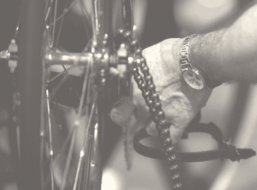
10 points for anyone who names this monster "A cyclist has nothing to lose but his chain"
PTP Runner Up 20150 -
pdstsp wrote:I think the second one above is brilliant - I can imagine suffering up there - particularly in the bit you can't see round the corner.
jenkins chapel I think?
tough climb
some "suffering" for you just after that corner")
 0
0 -
Shockedso shocked - Kingsdale?
Now edited - no.0 -
-
that piccy with the gate is a lovely photo..nice one... not sure about how to make steep look steep...presumably have a side shot of someone standing on the pedals as they ride by with the bars up by their chest...0
-
It's an interesting question. I've taken photos on some steep hills and sometimes I can't even tell from a picture whether I was looking up a hill or down it. Sometimes the hills really don't look steep at all. I think it helps to keep the camera horizontal and avoid the temptation to point it up or down the hill.
Here's a few local hills which I've just about managed to capture the severity of... Mytholm Steeps (Climb Church Lane from Hebden Bridge towards Blackshaw Head)
 Highfield Crescent, Hebden Bridge (Well over 25% - must try and ride it some time)
 Cobbled climb to Old Chamber (follow concrete road up through woods at the back of Hebden Bridge railway station. NB - dead end road)
 Deanhead climb from Scammonden Water, next to M62
 Thursden near Widdop on road from Colne to Hebden Bridge
 Horsehold Road (cross canal by Hebden Bridge Co-op and turn right. NB - dead end road, unless you have a 4x4 or a mountain bike) 0
 -
0
-
-
The daddy of them all!
And that's me on a 39x25 fact fans"In many ways, my story was that of a raging, Christ-like figure who hauled himself off the cross, looked up at the Romans with blood in his eyes and said 'My turn, sock cookers'"
@gietvangent0 -
disgruntledgoat wrote:The daddy of them all!
And that's me on a 39x25 fact fans
Looks like the east side of Wynose0 -
West side of Hardknott, on the S Bends.
Props to the guy who took that by the way, I just did the riding. I love the way you can see where the road has come from about 15 metres below it."In many ways, my story was that of a raging, Christ-like figure who hauled himself off the cross, looked up at the Romans with blood in his eyes and said 'My turn, sock cookers'"
@gietvangent0 -
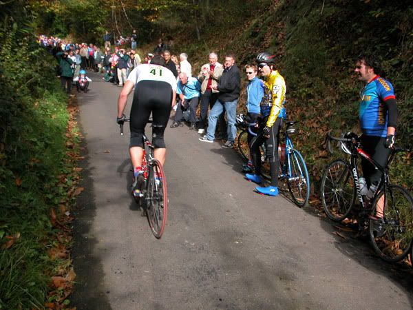
I think the trick is to try not to take a picture looking straight up/down the road, or at least try to get some road going up the hillside at an angle in the background. Looking at the picture of DG going up Hardknott above, if it weren't for the bit of road snaking away in the background you'd never know it was super steep, but I know full well it is! IMO the photo here which best gives you an idea of how steep the climb is is the fifth one down of Colin J's post, because you can see the road going up at an angle it gives you a much better idea of the gradient.
Edit: where was that fifth photo taken Colin?0 -
Use a wide angle lens, telephoto or long lenses compress perspective and make hills/distances look shorter and compressed. Obviously if you have visual markers like the buildings in that link to the photo of the bend in the town will dramatise and make a hill look steeper.Do not write below this line. Office use only.0
-
freehub wrote:
10 points to freehub! There is a better picture somewhere with the sign saying "cyclists dismount", where the road seems to just drop off a cliff!"A cyclist has nothing to lose but his chain"
PTP Runner Up 20150 -
I've gone back and put captions on all the photographs now.nasahapley wrote:IMO the photo here which best gives you an idea of how steep the climb is is the fifth one down of Colin J's post, because you can see the road going up at an angle it gives you a much better idea of the gradient.
Edit: where was that fifth photo taken Colin?0 -
You need a strong vertical element in the image that reminds the eye/brain about the gradient. The stepping effect of houses or fenceposts on a climb, tree trunks, or a line of people standing along it.
Also the Fred Whitton photo posted previously works because the little cyclists in the background show that the road below isn't very far away.0 -
ColinJ wrote:
I've gone back and put captions on all the photographs now.nasahapley wrote:IMO the photo here which best gives you an idea of how steep the climb is is the fifth one down of Colin J's post, because you can see the road going up at an angle it gives you a much better idea of the gradient.
Edit: where was that fifth photo taken Colin?
Cheers CJ, I really like the look of that one! I've figured out a route from Ilkley which takes in that and Mytholm Steeps that I hope to do fairly soon: http://www.bikehike.co.uk/mapview.php?id=23305. I still haven't explored West Yorkshire at all; it's obvious that there's no shortage of steep hills there though!0 -
Le Commentateur wrote:You need a strong vertical element in the image that reminds the eye/brain about the gradient. The stepping effect of houses or fenceposts on a climb, tree trunks, or a line of people standing along it.
Also the Fred Whitton photo posted previously works because the little cyclists in the background show that the road below isn't very far away.
Isn't that 2nd photo Yorks Hill in Kent?Do not write below this line. Office use only.0 -
I know that you have plenty of great cycling out your way, but it's definitely worth a trip over here from time to time. I'd also highly recommend the Forest of Bowland if you haven't cycled there before.nasahapley wrote:I still haven't explored West Yorkshire at all; it's obvious that there's no shortage of steep hills there though!
If by any chance you are free on Sunday and could get to Hebden Bridge by 10:00 you'd be welcome to come along on this ride I've organised over on the CycleChat forum.
PS I like the look of your route, but I'd suggest changing the section through Colne and going via Laneshaw Bridge and Trawden instead (as my ride does on Sunday if you look at the map). Lovely little lanes rather than busier roads.
Oh, I've just noticed - you've made the mistake of thinking that all things named 'lanes' on the mapping software are actually roads - they aren't! We get loads of people being sent up and down them by their GPSs. They are basically bridleways or farm tracks. Here's the one you've marked from Blackshaw Head:
Here's another one that people get stuck on:
which actually becomes this further on...
They may have been ancient lanes, but they aren't what you'd think of as lanes now! Remember to check the OS map up to the top right!
To come back from Blackshaw Head, turn right and descend to Jack Bridge, climb back up through Colden, and descend back to Slack which you passed through earlier.
NB Be careful at the lights at the bottom of Heptonstall Road - they don't stay green long for traffic coming down the hill and loads of drivers on the A646 jump the lights (I think they are accidentally looking at the lights for the hill).0 -
Headhuunter wrote:Use a wide angle lens,
What about panoramas - loads of photos stitched together? Is that an acceptable substitute for a wide-angle lens? I've done it, but it still looks flat.

I've still got a few photos from yesterday which I have to stitch together; maybe they might look ok...
The problem is - most of my local hills have nothing... NOTHING near them for miles, so using buildings and stuff to show how steep they are is not possible. The first photo has Manchester in the distance, which gives the impression that you're high up, but no impression of how steep the road is. All the fences/walls along the road follow the gradient, so add to the illusion that it's flat. :x 0 -
Bhima wrote:Headhuunter wrote:Use a wide angle lens,
What about panoramas - loads of photos stitched together? Is that an acceptable substitute for a wide-angle lens? I've done it, but it still looks flat.
I was thinking more along the lines of a wide angle lens with some kind of indication of gradient like buildings on ones side, or taking the photo at the apex of a bend in the hill or as someone pointed out above, trying to get the hill in a diagonal across the shot. Simply taking a shot of a straight stretch of hill from one side just ends up looking like a flat bit of road.Do not write below this line. Office use only.0 -
Look at this photograph...

Sometimes when I look at it, I think it is taken looking up the hill. Actually, it is taken from the top looking down and the gradient is about 15% - very deceptive.0 -
As Le Commentateur you need to try to get a fixed reference point in that allows your eyes to appreciate the angle. Buildings do the job well but as the best hills are out in the countryside this isn't always easy. The hairpin photo above works as someone pointed out as it shows the drop over the switchback and the rider lower down gives perspective on distance. Even the pro photographers don't often manage to overcome the problem. Long shots back at a bunch on a straight road often leave me wondering if they have just come down a steep hill and are onto the flat of have just come off the flat onto a steep climb.
Of course, it helps if you are using really steep Welsh climbs instead of those namby pamby bumps you class as hills in England 0 -
Just dug out the only pic I've got of a steep hill, no bikes in it but it's not too bad (following on from Le Comm's post, I think the trees do indeed help to show how steep it is).
Where's this then?
Colin J: cheers for the route tips, re-jigged it a bit to keep it on-road and off busy roads! Your Sunday route looks like a right beast - would love to come along but already have plans, if you're doing other rides over the winter I should be able to make it to some of them so I'll keep an eye on C**** Ch**.0 -
The problem with taking photos looking downhill is that you tend to tilt the camera down in an attempt to photograph the road.
If the point is to capture the steepness rather than the quality of the tarmac, keeping the horizon in the centre of the frame and just getting an impression of the road at the very bottom of the picture should give much better results.0

