Google maps navigation?

Valy
Posts: 1,321
Hi all,
I'm planning a trip to France during Le Tour and plan to get to Besançon and then cycle from there to 2 other stages. I've managed to get some decent routes planned on Google Maps, but I'm not sure of a way use those routes in a GPS mode on an Android phone?
Meaning I draw a route and then put it into my phone and then make my phone keep me on it with the use of GPS.
Does anyone know of a way to do this? I could use a map... suppose I have not been to New Zealand.
0
Comments
-
Do you mean a map you've drawn and saved in myMaps?
If you go into the edit mode you should then see a link with the text 'kml' . This enables you to download your route in kml format. Unfortunately, so far as I know most GPS software uses routes/tracks in GPx format so you need to convert the file - I normally use gpsies.com. I would upload the routes as 'track' rather than 'routes' - unless you are familiar with, and trust, the software.0 -
Do you mean a map you've drawn and saved in myMaps?
Exactly - I got the file converted but now not sure how to make Navigation use it? Could not find any folders on the phone to place the file. Would I need something else to allow me to use the .gpx file?0 -
Valy wrote:Do you mean a map you've drawn and saved in myMaps?
Exactly - I got the file converted but now not sure how to make Navigation use it? Could not find any folders on the phone to place the file. Would I need something else to allow me to use the .gpx file?
I don't own an Android device, but I'm fairly sure you will need additional software eg ViewRanger.0 -
You'll need to make sure you have maps stored on your phone or you'll run up massive data costs. Also, I guess you're not planning on cycling for more than 2 or 3 hours a day otherwise you'll have battery issues.
Given what you're trying to do you'd be better using something like bikehike which will throw out either a .tcx or .gpx file for you, yet still allows you to plot a route using Google maps. Google maps itself is rubbish for plotting routes (fine in 'satnav mode' though). Loads of android apps for cycling, but I don't know which would be best for navigation as I don't use them.More problems but still living....0 -
Right... looks like I will need to get my head down and do some planning with the things you guys suggested. Now I at least feel like I got a chance of getting to the places I need!

Thanks!0 -
You dont need special software.. go to google maps on the phone and select layers. Choose my places and select the route you have saved on my places previously on the pc. Press the compass keys twice to rotate and centre automatically. Set a comfortable zoom level.
You can pre-cache the area direct to phone memory in 10mile chunks to save having to download the route on the fly and costing a ton in bandwidth.
Biggest downside is battery life. Running the screen and gps clobbers the battery and you'll be lucky to get more than a couple of hrs continuous use.
I'd say give it a go in Yookay before you go and see if its usable for you. As others have said, you can convert the .kml to .gpx fairly easily and use a dedicated gps device. I think you can get some non-garmin devices for about 100pounds these days
HTH!
Rich0 -
Wow, never thought about that - seems ideal apart from maybe the screen time out, but I guess that can be sorted with setting it to 30 minutes or rooting the phone... which seems easy :shock:
For battery related troubles I though of getting a solar charger and just leaving it plugged in. Wonder if it will have enough power in it though to run non-stop for a few hours. Anyone have experience?0 -
Yeah, i set my phone to 30mins time out... just got to remember to touch the screen every now and again to reset the timeout... Power monkeys with solar charger are available for about £25 off Amazon. I've yet to try my one out tho' 8)0
-
If you want to use a googlemap route on a GPS, look up "gmap2gpx"
Download & install, create a route in googlemaps (right-click --> route from here, right-click --> route to here, drag route onto desired roads), then select the gmap2gpx off your bookmarks (where the install put it). This takes you to a page with a choice of gpx data. Select this and copy/paste into a text file, which you then rename to "myroute.gpx" and send to the GPS0 -
An app called Keepscreen will keep the screen on
 you can configure it so it only works with Google Maps. 0
 -
Hello again all,
I have had a freaking nightmare - lost a map/route which I had adjusted down to a tee and then just... deleted it somehow... *facepalmx100*
I do have the KML saved onto the desktop though - just one problem. I want to upload it to Maps so that I have the route as a line - like when you get directions from a-b and then you can drag that line as you please. When I upload it now I get a series of tiny squares which end up forming the line and you cannot adjust them and they don't show all at once, the most retarded thing is that when I upload the KML file to Earth - it displays 100% perfectly!
I have also tried converting the KML to a GPX and KMZ file to no avail - the squares change to a series of circles.
Here are the screenshots of the line which you can drag at will: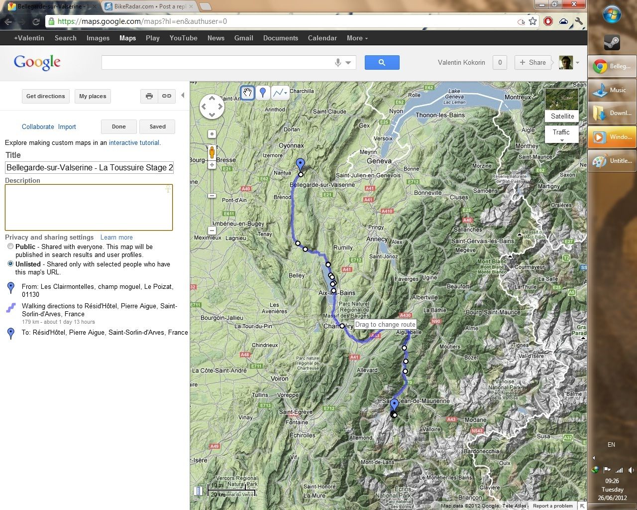
and here is the original uploaded: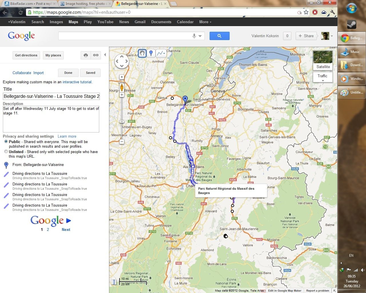 0
0