What's a "steep" hill?

pottssteve
Posts: 4,069
Hi All,
I always ride alone so have nobody to compare myself with, hence the question.
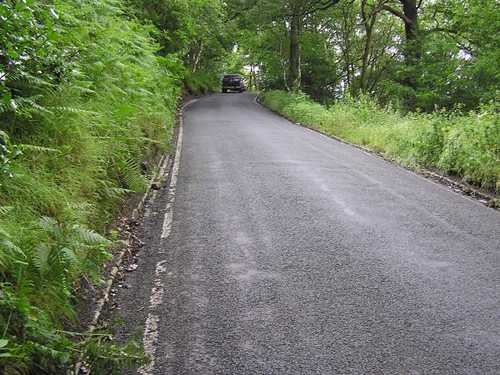
My regular ride has a couple of hills in it. One is about 1km long and has a gradient of between 4 - 5%. The other is shorter (about 500m) but a bit steeper (5-6%). Would you class these as difficult hills, as I really struggle, especially on the second one. By the way, the downhill of the second climb is a very twisty 8-10% - brakes full on!! :shock:

I always ride alone so have nobody to compare myself with, hence the question.
My regular ride has a couple of hills in it. One is about 1km long and has a gradient of between 4 - 5%. The other is shorter (about 500m) but a bit steeper (5-6%). Would you class these as difficult hills, as I really struggle, especially on the second one. By the way, the downhill of the second climb is a very twisty 8-10% - brakes full on!! :shock:
Head Hands Heart Lungs Legs
0
Comments
-
Are you asking what's steep or what's difficult?
I wouldn't say that 5% was all that steep but after 1km it's likely to be quite draining.0 -
I suppose I'm asking what other beginners would struggle with...Head Hands Heart Lungs Legs0
-
10% + never feels easy, even when you are fit.0
-
I guess it partly depends on the climate - are you really in Hong Kong ?
We went a couple of years ago, went up on that funicular railway to the top of the hill on HK Island, where there are lots of people running, jogging, cycling, rollerblading, etc.
Yes it's above the smog and a bit cooler because it's high up, but it was still 35+degrees and humid as hell so I'd have struggled a bit in it0 -
A beginner roadie but been MTBing for ages.
My morning road road (only 11.5 miles) contains a 200 metre (ish) long hill which is 30% at one point (for about 75 metres), a long 500 yards hill of around 10% and several other long hard climbs. I think our driveway is about 33% (aboutn100 yards long). They seem steep to me but MTB hills can be a lot steeper. I just stand up and push hard - occasionally slipping the rear wheel!0 -
-
I've got a hill near me that's a 1:5 gradient and i cannot do it, I can get about a tenth of the way up but always have to get off an push - which I hate doing. I stand and push with all of my might but there's just no getting up it.1993 - Ridgeback 301 G3
1995 - Ridgeback 601 GS
1997 - Specialized Hardrock
2003 - Specialized FSR XC
2008 - Specialized Epic FSR Comp
2009 - Giant Defy 3
2010 - Voodoo Wanga
2012 - Cannondale Supersix 1050 -
andy_wrx wrote:I guess it partly depends on the climate - are you really in Hong Kong ?
We went a couple of years ago, went up on that funicular railway to the top of the hill on HK Island, where there are lots of people running, jogging, cycling, rollerblading, etc.
Yes it's above the smog and a bit cooler because it's high up, but it was still 35+degrees and humid as hell so I'd have struggled a bit in it
Andy,
Yes, I really am in Hong Kong! Current weather conditions 29.7 degrees and 80% humidity (at 7.35pm).
Did you enjoy the Peak tram? There are a group of mentalists who live on HK island who regularly ride up to the Peak. I live in the New Territories where it's often a bit hotter and more humid. However, the riding's nicer. I'm going to look for a 10% climb around here and have a go...! :shock:
SteveHead Hands Heart Lungs Legs0 -
How do you guys know what gradient the hills are? I have difficulty picturing what 10%, 20%, etc looks like. Any photos that you could show me?Never argue with an idiot - they drag you down to their level and then beat you with experience0
-
Hornetto,
Many of my local hills come with these: http://www.freefoto.com/images/41/01/41 ... gn_web.jpg
Alternatively, if you subscribe to a site such as www.mapmyride.com you can draw a map of the ride and it will calculate the gradients for you.
SteveHead Hands Heart Lungs Legs0 -
steep would be anything over 20% for me. 15 - 20% are getting tougher. 10-15% aren't too bad. under 10% no bother.
everyones different!0 -
pottssteve wrote:andy_wrx wrote:I guess it partly depends on the climate - are you really in Hong Kong ?
We went a couple of years ago, went up on that funicular railway to the top of the hill on HK Island, where there are lots of people running, jogging, cycling, rollerblading, etc.
Yes it's above the smog and a bit cooler because it's high up, but it was still 35+degrees and humid as hell so I'd have struggled a bit in it
Andy,
Yes, I really am in Hong Kong! Current weather conditions 29.7 degrees and 80% humidity (at 7.35pm).
Did you enjoy the Peak tram? There are a group of mentalists who live on HK island who regularly ride up to the Peak. I live in the New Territories where it's often a bit hotter and more humid. However, the riding's nicer. I'm going to look for a 10% climb around here and have a go...! :shock:
Steve
Oh a mere 29.7C and only 80% humidity
(it's probably 14C and just started to pee-down here)
I guess that's mebbe alright if you're acclimatised to it, but I'd find it more than a bit draining.
Yes the Peak Tram was great - olde worlde (Victorian ?) charm.
Or at least the train itself was, the shopping mall thing at the top was a bit tacky !
We rode it up and then walked back down those hundreds of steps.
- there were some masochist types running up which looked bloody hard.
Those escalators were facinating too - couldn't believe escalators went halfway up the hillside...
Hopped on one of the trams at the bottom, bagged the front seat and just rode out til the thing terminated at the end (surprised the driver as we tramped down the stairs - we took a little while to realise it had stopped, he thought everyone had long got off)
It only cost pennies but excellent views, going through various districts from the (international) central business district out to the (very Chinese) suburbs.0 -
OK, so a hill near me using this works out at 240ft over 1.22 miles. What now?Mettan wrote:Use BikeHike or BikeRouteToaster to get the ft ascent and distance, then go from there.pottssteve wrote:Many of my local hills come with these: http://www.freefoto.com/images/41/01/41 ... gn_web.jpg Walked into that I guess! Never argue with an idiot - they drag you down to their level and then beat you with experience0 -
Convert your miles into feet then divide the 240 ascent by the distance travelled in feet.
i.e 1.22 miles = 6442 feet
240/6442 = 0.037 or a 3.7% hill. (or not very steep...)
Er. I think that's right!0 -
A lot of steep hills have gradient signs on them. I have mapping software and can calculate the average gradient over the length of a hill quite easily.Hornetto wrote:How do you guys know what gradient the hills are? I have difficulty picturing what 10%, 20%, etc looks like. Any photos that you could show me?
These two are about 25%...
This one is probably about 30%!
You can estimate the gradient riding uphill thus:
What hill? (1-2%)
This is an easy hill. (3-4%)
I'm starting to work harder. (5-8%)
I hope this doesn't go on much further! (9-12%)
Ouch! (13-18%)
Engage granny gear, stare at front hub, chew handlebar tape. (19-23%)
Double-check that you are in your granny gear, melt front hub with heat radiated from forehead, swallow chewed handlebar tape, emit startling primal scream, pray for the summit! (24-29%)
Die on bike, become reincarnated as a RiccoBassoValverde clone, laugh at mere mortals, climb with ease without even sweating. (Any gradient you like!)0 -
pickled wrote:Convert your miles into feet then divide the 240 ascent by the distance travelled in feet.
i.e 1.22 miles = 6442 feet
240/6442 = 0.037 or a 3.7% hill. (or not very steep...)
Er. I think that's right!
I think I must have messed up the figures there as that seems way too low. Having said that I don't live in a hilly area.
Thanks for the pics Colin, that helps a lot. I wouldn't be getting up those without serious difficulty!Never argue with an idiot - they drag you down to their level and then beat you with experience0 -
I think there's a maximum gradient "allowed" for a road hill. I remember cycling up one on Anglesey that was 35% (with sign) - used a zig zagging technique to get up it then nearly had lung explosion.0
-
-
Now I'm a bit confused!
If you have a look here: http://www.mapmyride.com/ride/hong-kong ... 2852533663 (you may have to zoom in a bit) the stretch between Km 24 and 25 is 1 km and has a height gain of 100m (I know this from a map I have). Therefore, wouldn't that make it a 1:10 or 10% hill, rather than the 4 or 5% shown by mapmyride?
I'm getting a bit obsessed about this bit of hill, but I'd like a benchmark! Head Hands Heart Lungs Legs0 -
0
-
pottssteve wrote:Now I'm a bit confused!
If you have a look here: http://www.mapmyride.com/ride/hong-kong ... 2852533663 (you may have to zoom in a bit) the stretch between Km 24 and 25 is 1 km and has a height gain of 100m (I know this from a map I have). Therefore, wouldn't that make it a 1:10 or 10% hill, rather than the 4 or 5% shown by mapmyride?
I'm getting a bit obsessed about this bit of hill, but I'd like a benchmark!
I will be honest, i wouldn't trust mapmyride.
I mapped Mont ventoux on it a month or two ago and compared it to the recognised km by km gradients on the web for Mont ventoux, there were large differences - see links below:
Recognised Km by Km gradients - http://en.wikipedia.org/wiki/Mont_Ventoux
Mapmyride - http://www.mapmyride.com/ride/france/bedoin/495048199
eg last Km looks very different 10% recognised v c6% MapmyrideMe struggling up Mont Ventoux for the first time! Done it 3 times since (each way up) without stopping. This seems like a lifetime ago! http://img208.imageshack.us/i/snapshot2 ... 45552.tif/0 -
Pickled,
Thanks, but not really. Like Hornetto, I'm after an idea of what a 10% gradient looks like as you climb it. As I said, I'm confused at mapmyride gives the hill as 5% but it is definitely 1km long with a climb of 100m (so 10%). :?Head Hands Heart Lungs Legs0 -
screebs - that looks nothing like the same hill! :shock:
Andy,
Hong Kong is the bomb. Some of my regular ride looks like this: http://www.panoramio.com/photo/16825476
But then some of it looks like this: http://travel.webshots.com/photo/279212 ... 2180gQFKFm
:shock: Head Hands Heart Lungs Legs0 -
Personally I count 15% and above as steep.
I am by no means a good climber, but I can cope with anything sub 15% for quite a while.0 -
If you want something more exact than mapmy ride or others, find a local map with contour lines on it, and work the elevation per distance out from that. A photo won't give you an idea of a 10% slope with any accuracy unless the photo was taken exactly from horizontal.
bikehike.co.uk has a useful gradient checker, but don't assume that it is correct either.0 -
Thanks, pompy,
That's what I would do in the UK, but the maps over here aren't as good.
SteveHead Hands Heart Lungs Legs0 -
Supplementary question which may muddy the waters yet further: are gradients normally calculated by
1) how much you climb compared to a nominal horizontal distance travelled "into the hill" as it were, or
2) compared to the actual distance covered on tarmac?
That is, is it the base of a right-angled triangle or the hypotenuse? Take for example a right-angled triangle where the height is 3, the base is 4 and the hypotenuse is 5: the gradient measured one way would be 3/4 (75%), but the other way would be 3/5 (a mere 60%, much easier!).
I have a nagging suspicion that this is a really dumb question but I can't see why..."We're not holding up traffic. We are traffic."0 -
msw wrote:Supplementary question which may muddy the waters yet further: are gradients normally calculated by
1) how much you climb compared to a nominal horizontal distance travelled "into the hill" as it were, or
2) compared to the actual distance covered on tarmac?
That is, is it the base of a right-angled triangle or the hypotenuse? Take for example a right-angled triangle where the height is 3, the base is 4 and the hypotenuse is 5: the gradient measured one way would be 3/4 (75%), but the other way would be 3/5 (a mere 60%, much easier!).
I have a nagging suspicion that this is a really dumb question but I can't see why...
I would say it's a very valid question, and for the purpose of cycling the gradient should be calculated as the actual distance travelled on tarmac vs height gained. Otherwise anybody could "climb" the height of Everest, so long as it was spread over a few hundred miles! Cycling weakly0 -
msw wrote:Supplementary question which may muddy the waters yet further: are gradients normally calculated by
1) how much you climb compared to a nominal horizontal distance travelled "into the hill" as it were, or
2) compared to the actual distance covered on tarmac?
That is, is it the base of a right-angled triangle or the hypotenuse? Take for example a right-angled triangle where the height is 3, the base is 4 and the hypotenuse is 5: the gradient measured one way would be 3/4 (75%), but the other way would be 3/5 (a mere 60%, much easier!).
I have a nagging suspicion that this is a really dumb question but I can't see why...
I do not know the definitve answer - but from a maths point of view, the base would be used. Skyd0g are you sure? I'm not sure why your mount everest example discounts the rise/base method.
And think of those stage profile maps - they tick kms off along the base, and i presume that they would talk about climbing 100 m from the 5km mark to the 10 km mark. Do those distances refer to actual travelled distance, (i.e lots of hypotenuse added together) or "map" distances - (ie triangle base).?0
